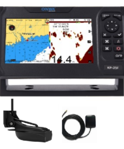
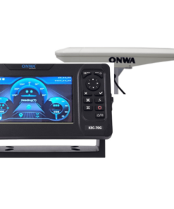
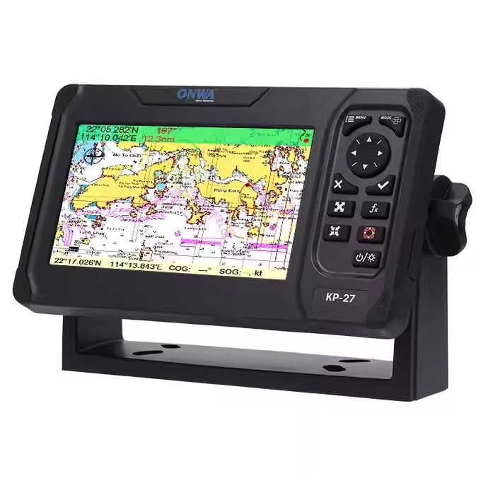
GPS Chart plotter

A GPS chart plotter is a navigation device used primarily in maritime and aviation contexts to display and track a vessel or aircraft’s position on electronic charts. It integrates GPS (Global Positioning System) technology with digital mapping software to provide real-time positioning data and visual representation of the vessel’s track overlaid on digital charts.

GPS chart plotters offer a range of features including route planning, waypoint navigation, and automatic tracking. They typically display information such as speed, course, heading, and distance to destination. Users can input waypoints, create routes, and set alarms for navigational hazards.

These devices are essential for safe and efficient navigation, offering mariners and pilots accurate and reliable information about their position relative to surrounding geography, navigational aids, and potential hazards. GPS chart plotters have largely replaced traditional paper charts and manual navigation methods, providing greater convenience, accuracy, and situational awareness.

NAVCOM Enquiry

If you need marine communication equipment, radio survey, service, repair, or installation, SEANAV MARINE is here to help. Contact our team today.

FAQ Answer
What is a GPS chart plotter? A GPS chart plotter is a navigation device used to display and track a vessel or aircraft’s position on electronic charts using GPS technology.
How does a GPS chart plotter work? It integrates GPS technology with digital mapping software to provide real-time positioning data and visual representation of the vessel’s track overlaid on digital charts.
What features do GPS chart plotters offer? They offer features such as route planning, waypoint navigation, automatic tracking, speed, course, heading display, and distance to destination.
Why are GPS chart plotters essential for navigation? They provide accurate and reliable information about a vessel’s position relative to surrounding geography, navigational aids, and potential hazards, ensuring safe and efficient navigation.
What benefits do GPS chart plotters provide over traditional navigation methods? They offer greater convenience, accuracy, and situational awareness compared to traditional paper charts and manual navigation methods.
Can GPS chart plotters be used in both maritime and aviation contexts? Yes, GPS chart plotters are used in both maritime and aviation contexts for navigation and tracking purposes.
How do users interact with GPS chart plotters? Users can input waypoints, create routes, set alarms for navigational hazards, and customize display settings using the device’s interface.
Are GPS chart plotters reliable? Yes, GPS chart plotters are reliable navigation devices when properly maintained and used in conjunction with other navigational aids.
What types of charts do GPS chart plotters support? They support various types of electronic charts, including raster charts, vector charts, and ENC (Electronic Navigational Charts).
Can GPS chart plotters be integrated with other onboard systems? Yes, GPS chart plotters can be integrated with other onboard systems such as radar, AIS (Automatic Identification System), and sonar for enhanced navigation and situational awareness.
[/col] [/row] [/message_box]